طرح تجدید نظر در برنامهی توسعهی اراضی عباسآباد، اثر سیدهادی میرمیران، حمید میرمیران
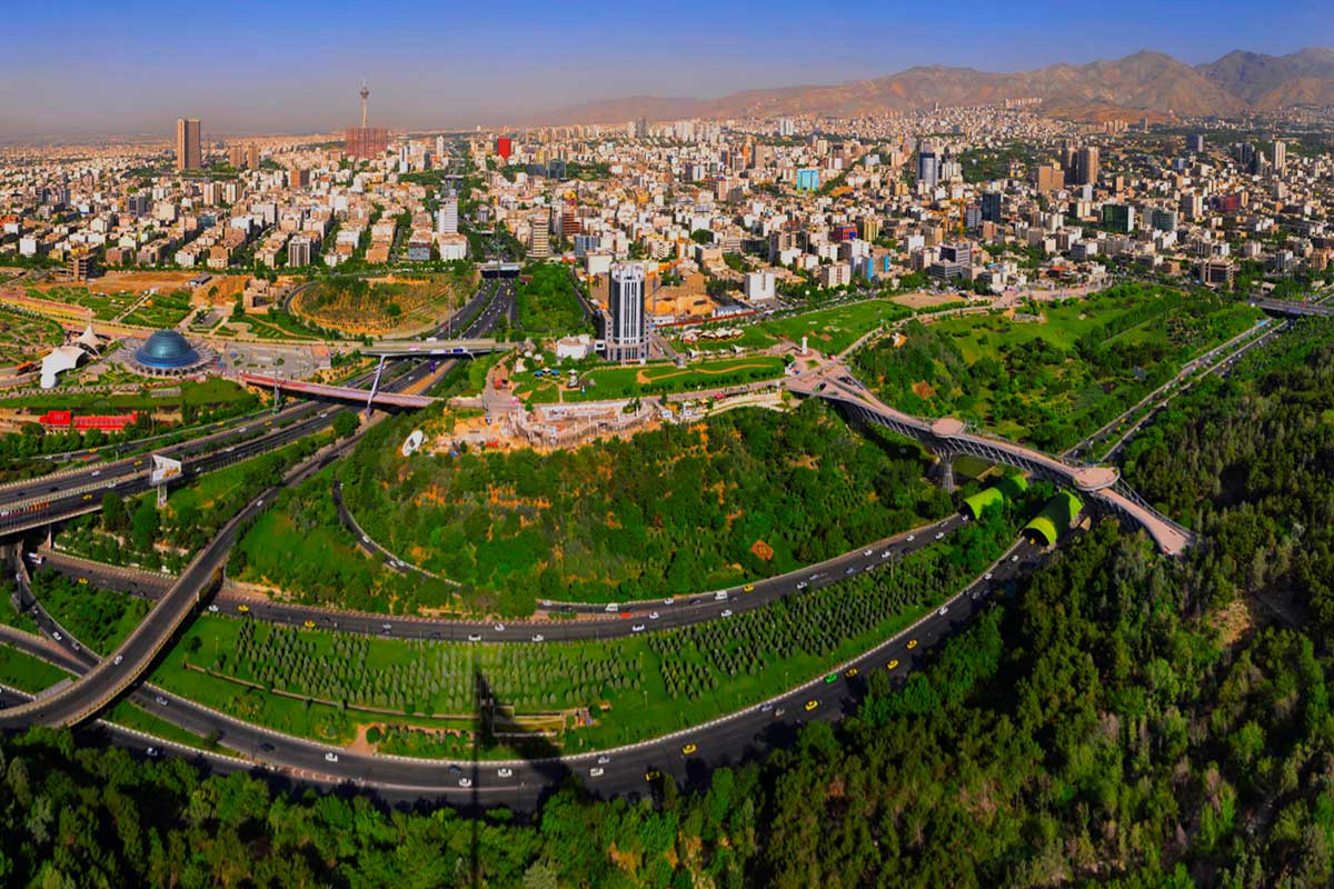

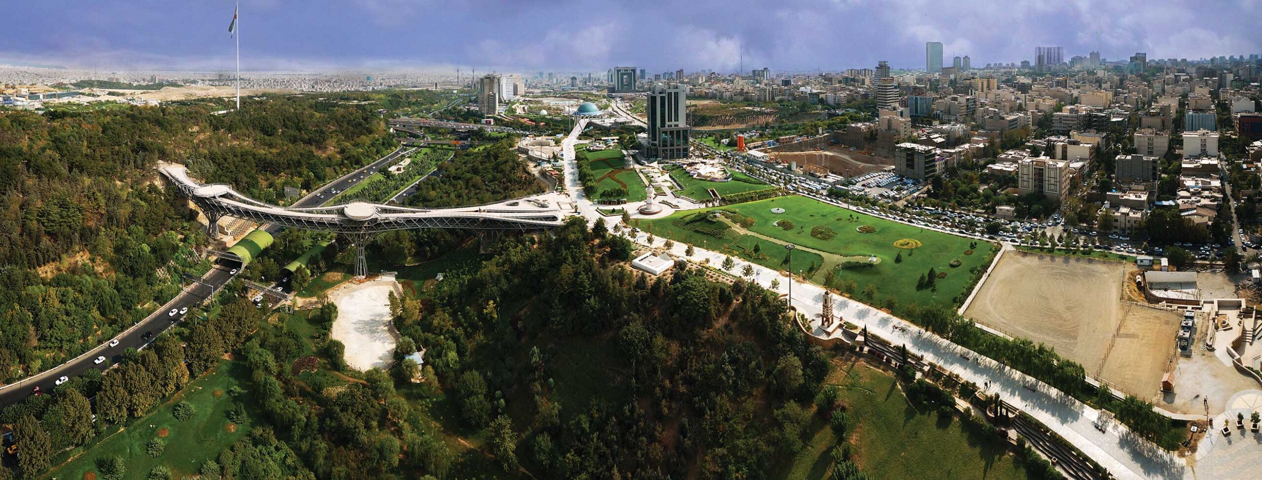
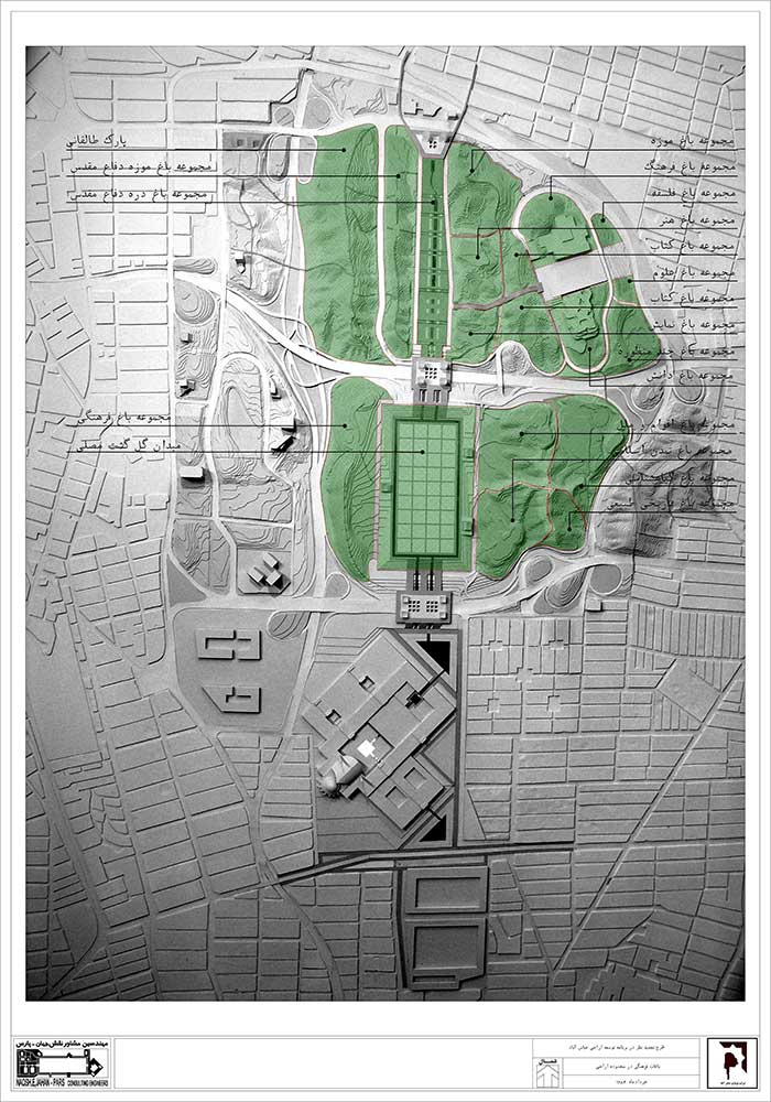
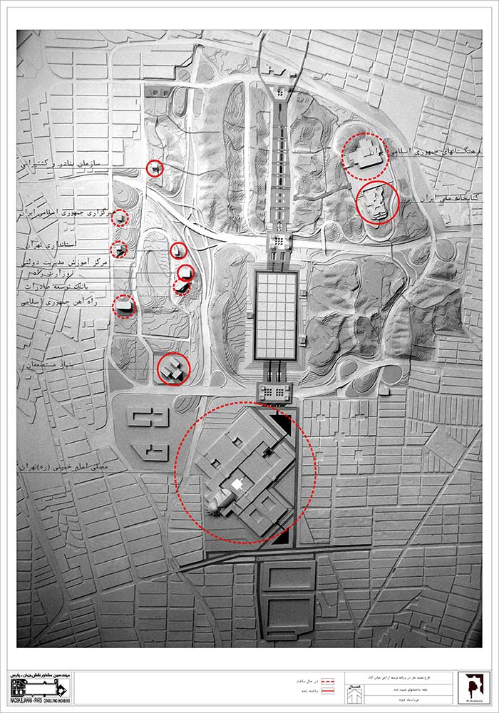
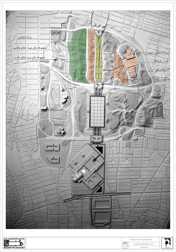
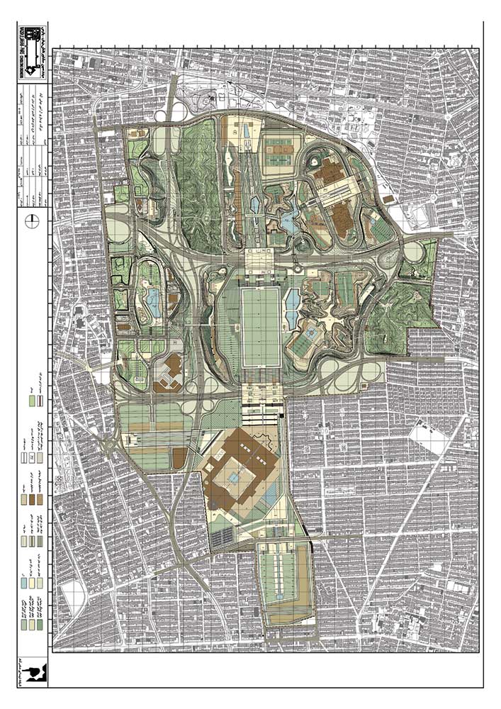
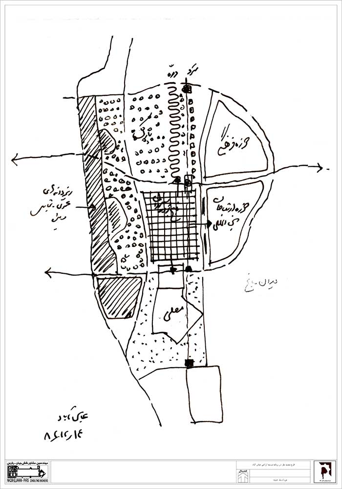
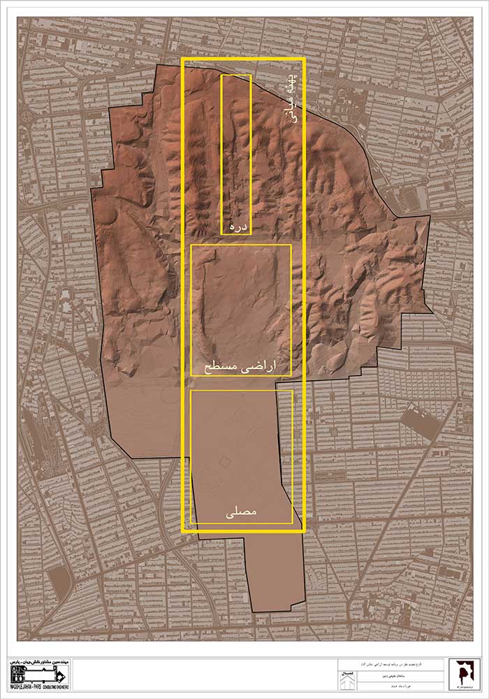
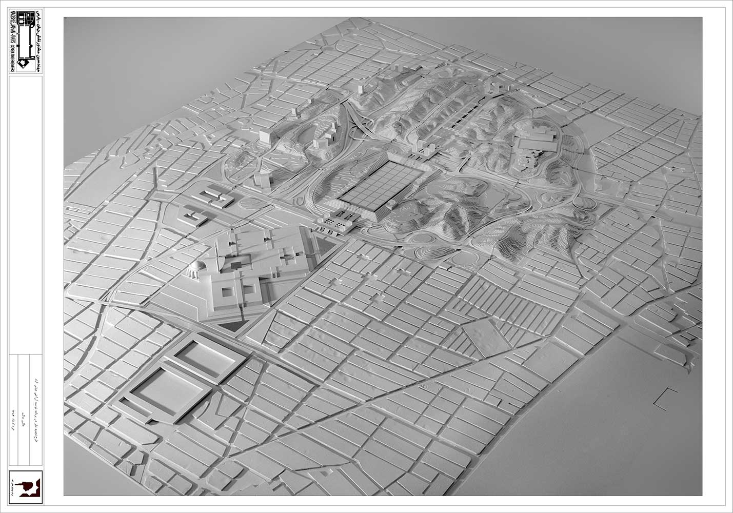
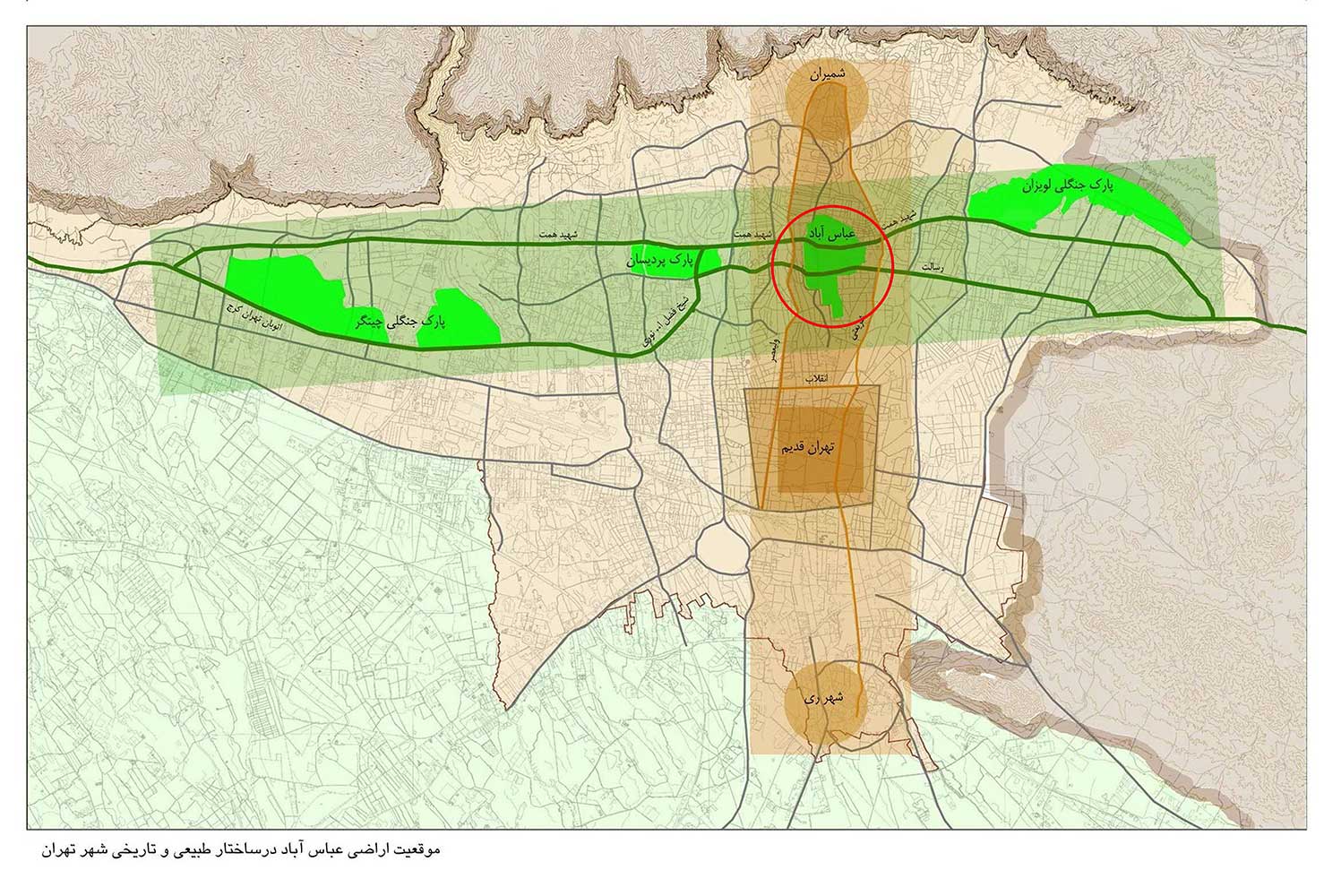
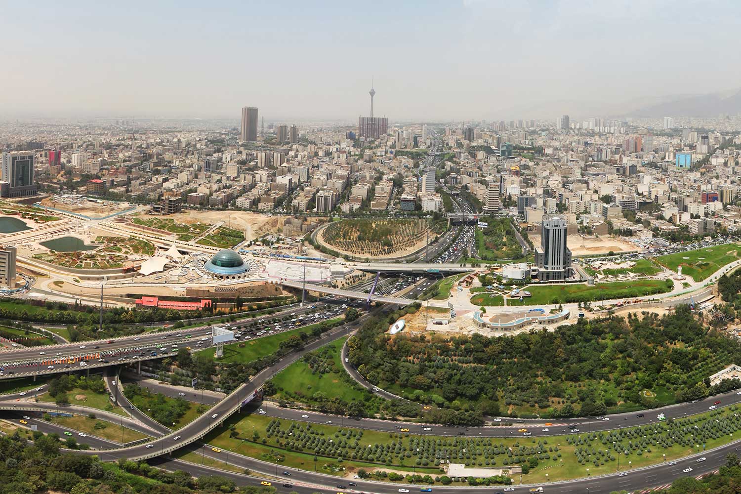
اراضی عباسآباد با مساحت حدود 539 هکتار از یک موقعیت خاص استراتژیک برخوردار هستند و 63 هکتار آن به احداث مصلی تهران اختصاص داده شده است. طرح فرمانفرمائیان، گروئن (1347) به عنوان اولین طرح و طرح مشترک شرکتهای آتک و آرکولوگ (1377) به عنوان آخرین طرح برای آن تهیه و تصویب شده بود؛ اجرای این طرحها برای مدتی در دستور کار قرار گرفت اما بر اساس رهنمودها و مصوبات طرح آخر مقرر گردید که در طرح، تجدید نظر به عمل آید و طرح جدیدی تهیه گردد. طرح تجدید نظر به چهار شرکت مهندسین مشاور پارهاوس، شاران، فرنهاد و نقش جهان پارس واگذار گردید و دو گزینهی پیشنهادی ارائه شد که گزینهی دوم مورد تایید قرار گرفت اما در نهایت، رویکرد سوم که بین دو رویکرد اول و دوم جای دارد و متناسب با توسعهی پایدار است، مد نظر مشاور قرار گرفت که توجه اصلی به مصلی شهر تهران بوده است. در این طرح، یک محور پیادهی شمالی-جنوبی اصلی در نظر گرفته شد که از جنوب به مصلی و از طرف دیگر به بزرگراه شهید حقانی (جهان کودک) منتهی میشود. در طول این محور، فضاهای عمومی مانند باغ گلگشت مصلی (میدان بزرگ شهر) و باغدرهی دفاع مقدس جانمائی گردیده، به ترتیبی که در طول محور، دید به کوههای البرز و مصلی قطع نگردد.
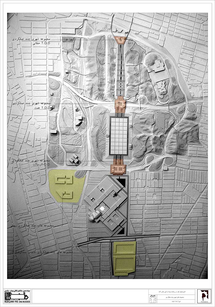
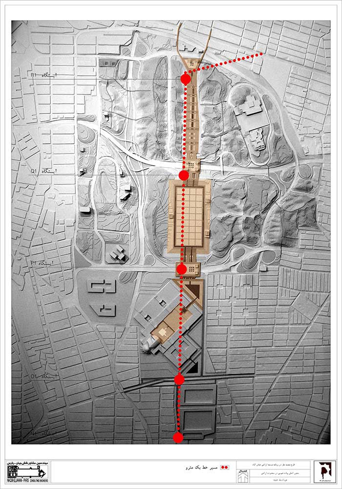
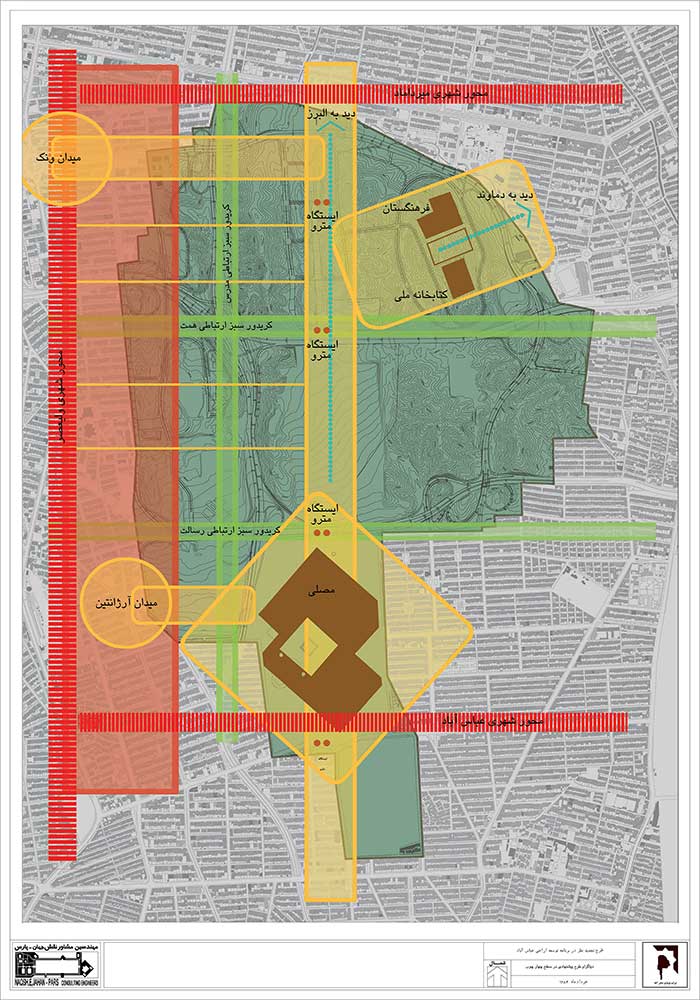
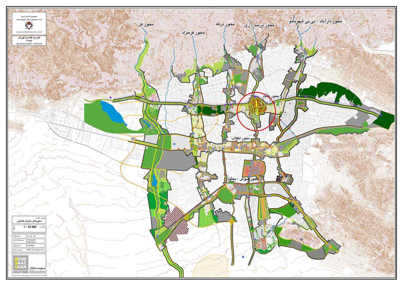
سه ایستگاه از خط یک مترو، منطبق بر این محور است و در محل ایستگاههای مترو که در کنار خیابانهای اصلی واقع شده، صفهها و سکوهای عریض پیاده در نظر گرفته شده است. این محور در کنار سه محور از محورهای اصلی ارتباطی شهر تهران (مدرس، همت و رسالت) قرار دارد که این سه محور، اراضی را به هفت حوزه تقسیم میکنند.
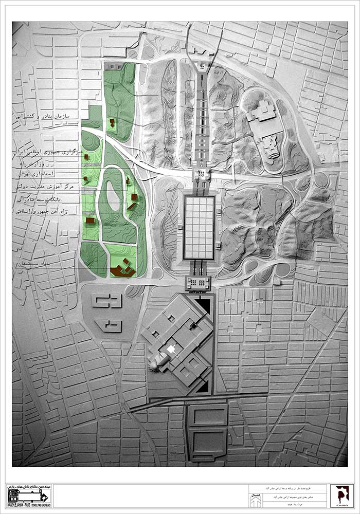
در این طرح، بناهای موجود و برخی بناهای در دست اجرا، حفظ شده و به کمک محوطهسازی و ایجاد یک دریاچهی مصنوعی، سازمان یافتهاند. میدان فرهنگ و مجموعهی پیرامونی آن در گوشهی شمال شرقی اراضی عباسآباد واقع شدهاند؛ مجموعهی فرهنگستان، کتابخانه ملی و باغ کتاب توسط یک محور پیاده، به محور شمالی-جنوبی اصلی مجموعه متصل میگردند؛ در ضلع شرقی، پارک جنگلی طالقانی، باغ-موزهی دفاع مقدس قرار گرفته است و در بقیهی اراضی ضمن حفظ توپوگرافی زمین، بناهایی متناسب با عملکرد در آنها احداث میشوند. برای تکمیل مجموعه و به منظور بهتر کردن بیلانهای هزینه-فایده در اراضی، یک مجموعهی چندعملکردی در محل پارکینگ بیهقی (جنوب شرقی مجموعه) در نظر گرفته شده و به این ترتیب، هدف غایی طرح یعنی ایجاد فضاهای سبز و فرهنگی برای مجموعه اراضی، محقق میگردد.
نظر به اینکه این اراضی از نظر موفولوژیک و اکولوژیک یک کلیت واحد و تفکیکناپذیرند، منطقی نیست که در سه منطقهی تهران تقسیم شوند؛ بنابراین در طرح پیشنهاد شده است که مدیریت کلیهی اراضی به صورت واحد و تحت نظر شرکت نوسازی عباسآباد درآید. علاوه بر آن، نحوهی برخورد و استفاده از اراضی، مجموعه قوانین و ضوابط خاص خود را نیاز دارد، لذا پیشنهاد شده است که مجموعه اراضی عباسآباد به عنوان یک منطقه با مالکیت عمومی که با قوانین و ضوابط متناسب با مقیاس و عملکرد آن مدیریت و بهرهبرداری میگردد، مد نظر قرارگیرد.
کتاب سال معماری معاصر ایران، 1400
________________________________
معماری و شهر سازی
________________________________
عنوان پروژه: طرح تجدید نظر در برنامهی توسعهی اراضی عباسآباد ( طرح جامع فضایی-کالبدی اراضی عباسآباد)
کارفرما: شهرداری تهران، شرکت نوسازی عباسآباد
مساحت پروژه: 539 هکتار
محل قرارگیری پروژه: تهران، تپههای عباسآباد
مدیر طرح و مدیر طراحی: سیدهادی میرمیران، حمید میرمیران
مشاور عالی طرح: ایرج اعتصام
مشاورین طراحی: غلامرضا کاظمیان، محمدرضا مثنوی، ابراهیم سینا
مسئولان هماهنگی: فریده صائبی، امیرپویا اصغری
همکاران طراحی: سامان سیار، بهارک کشانی، علی فرزدی، لیلا اکبری، پونه وکیلیان
مطالعات برنامهریزی شهری: غلامرضا کاظمیان
مطالعات اجتماعی و اقتصادی: محمد سالاری
مطالعات برنامهریزی معماری: نادر روزرخ
مطالعات ترافیکی: مهندسین مشاور آمودراه
مطالعات تاسیسات زیربنایی: مهندسین مشاور انرژی
مطالعات سیویل: سید محمدحسین مصطفوی
گروه ماکت: حمید عسکری، علیرضا خسروی
گرافیک و ارائه: رضا سلطانیزاده
تدوین و نگارش: علیرضا کریمپور
شرکت: مهندسین مشاور نقش جهان-پارس
عملکرد: طرح ویژهی شهری، مرکز اجتماعی و گردشگری
مجری: شرکت نوسازی عباسآباد
آدرس پروژه: تهران، تپههای عباسآباد
تاریخ شروع ساخت: سال 1384
عکاس پروژه: شرکت نوسازی عباسآباد
وبسایت: www.njp-arch.com
ایمیل: info@njp-arch.com
اینستاگرام: hamidmirmiran_architect@
Revision Plan in Abbas Abad Land Development, Seyed Hadi Mirmiran, Hamid Mirmiran
Project Name: Revision Plan in Abbas Abad Land Development (Comprehensive Spatial-Physical Plan of Abbas Abad Lands)
Client: Tehran Municipality، Abbas Abad Renovation Company
Area: 539 hectares
Design Managers: Seyed Hadi Mirmiran, Hamid Mirmiran
Senior Project Consultant: Iraj Etesam
Design Consultants: Gholamreza Kazemian, Mohammadreza Masnavi, Ebrahim Sina
Coordinators: Farideh Saebi, Amirpooya Asghari
Design Team: Saman Sayar, Baharak Keshani, Ali Farzadi, Leila Akbari, Pooneh Vakilian
Urban Planning Studies: Gholamreza Kazemian
Social and Economic studies: Mohammad Salari
Architectural Planning studies: Nader Roozrokh
Traffic Studies: Amudrah Consulting Engineers
Infrastructure Installation Studies: Energy Consulting Engineers
Civil Studies: Seyed Mohammad Hossein Mostafavi
Scale Model: Hamid Askari, Alireza Khosravi
Graphics and Presentation: Reza Soltanizadeh
Writing and Editing: Alireza Karimpour
Company: Naghsh-e Jahan Consulting Engineers – Pars
Function: Special Urban Plan, Social Center, and Tourism
Chief Engineer: Abbas Abad Renovation Company
Project Address: Abbas Abad hills, Tehran
Date: 2005-…
Photographer: Abbas Abad Renovation Company
Website: www.njp-arch.com
Email: info@njp-arch.com
Instagram: @hamidmirmiran_architect
Abbas Abad lands with an area of about 539 hectares have a special strategic position. Sixty three hectares of it is dedicated to the construction of Tehran Mosalla. The Farman Farmaeian-Gruen plan (1995) as the first plan and the Atek and Arcolog companies plan (1998) as the last joint plan for it had been prepared and approved. The implementation of these plans was on the agenda for some time but based on guidelines and approvals, the last plan had to get revised as a new plan. The revision plan was assigned to four consulting engineering companies, Parhouse, Sharan, Farnhad and Naghsh Jahan Pars, and as a result two options were proposed of which the second one was approved, although eventually, the third approach, which was derived from the first and second options, got finalized. This approach was in accordance with sustainable development and its main focus was on Mosalla in Tehran. The design had a main north-south pedestrian axis which led to Mosalla from the south and from the other side to the Shahid Haghani highway (Jahan Koodak). Along the axis, other public spaces like Mosalla’s Golgasht (the grand square of city) and Baghdarreh museum were located in a way that the views of Alborz and Mosalla mountains were not disturbed.
Three stations of the first line of the Tehran metro correspond to this axis, and in the metro stations, which are located next to the main streets, wide pedestrian platforms are designed. This axis is located next to the three main communication axes of Tehran (Modares, Hemmat and Resalat), which divide the lands into seven areas.
In this plan, the existing buildings and some of the projects under construction have been preserved and organized with the help of landscaping and the creation of an artificial lake. Farhang Square and its surrounding complex are located in the northeast corner of Abbas Abad lands; Fahangestan complex, the national library, and the book garden are connected by a pedestrian axis to the main north-south axis of the complex. On the eastern side, Taleghani Forest Park, there is a garden-museum of the Iran-Iraq war and on the remaining lands, while preserving the topography of the land, new buildings in accordance with the function of the whole complex are constructed. In order to complete the complex and to improve the cost-benefit balances of the lands, a multi-functional complex has been designed in Beyhaqi parking lot (southeast of the complex) by which, the ultimate goal of the project i.e. creating green and cultural spaces for the complex was achieved.
Given that these lands are morphologically and ecologically an inseparable whole, it does not make sense to divide them in three regions of Tehran. Therefore, in the plan, it is proposed that the management of all of it be under the supervision of Abbas Abad Renovation Company. In addition, using the lands requires its own set of rules and regulations, so it is suggested that the Abbas Abad complex gets managed as a publicly owned area with rules and regulations appropriate to its scale and function.

